|

CSOB Cockpit
Wx
&
Garmin
GPSMAP
Mounting
On
Cygnet
Dual Yoke
(Because Flying
Safely with Weather Avoidance Doesn't Have to be Expensive!)
Download the January 2008 ABS
Article:
Nexrad
on a Budget
Back when I
was living in Tampa, FL, the thunderstorm capital of North America (perhaps even the world), my goal was
to get XM Nexrad Wx into my cockpit at the lowest possible cost. I started out
with the concept of using one of the Garmin Auto/Marine
GPSMAP units that were equipped with the GXM30 low profile XM radio receiver. I
chose the GPSMAP 376C
since it was readily available and already superseded by newer models, which
made the purchase cost quite low for the 376C. The 376C can be
purchased
for about 1/3 the cost (via EBay in new or open box/display model condition) of an Aviation Garmin GPSMAP396!
Add the "Auto Kit" for about $200 (with detailed street mapping CD,
storage card and extra power plugs) for the Garmin units and you have a powerful
land based airport database, hotels, restaurants, shopping and street by street
directions to anywhere.
One of many Auto
Kit Sources: Click
Here or Click
Here
Of course the
376C has none of the highly touted aviation navigation and database
of airports, intersections, airspace,
etc., however,
for my purposes this was not an issue. I already had a panel mounted IFR
certified GPS with aviation moving map display and a small battery powered
aviation handheld GPS with an aviation database.
See a complete
customer review of 376C Features: Click
Here
I simply
wanted to get the important Nexrad capability in my plane
for strategic in-flight decision making. It does not hurt
that
the 376C is a WAAS capable GPS unit for an emergency navigation backup in the
event of a complete electrical failure or panel mounted GPS equipment
failure.
NEWS FLASH:
Check out this Airport and VOR database upload discovery from a site called
Navzilla that
makes it easy to upload the US Airports and VORs to your 376C

You have to become a member of the site to
download the latest Airport and VOR database files.
Once you sign up with Navzilla, this page
will have lots of 376C info
HERE
You download the little utility called
G7toWin and use
that utility to load the
Airport or
VOR
database you got from Navzilla (after you sign up) thru the USB connection to the 376C. When you use
the G7toWin "File Open" command, you must open the menu box for files of type
"txt" because that is the file type of the Airports and VORs database.
Read about the G7toWin utility and the
developer HERE
Caution: Your 376C has room for 3,000
Waypoints. There are ~4,900 airports and ~1,000 VORs, so you have some choices
to make.
I decided to load all the VORs onto my 376C
and the G7toWin utility with Navzilla's VOR data file and it works great. I now
have every VOR in my CSOB 376C so in a pinch I could get navigate to any VOR and
most public airports.
I found that
XM's
Sailor Weather package
at $29/month (side note, when you subscribe
to a Weather product you get XM Radio for $8/month - a no brainer for me since I
can run the audio out to the Garmin 340 audio panel in the plane and set my cars
up) gave me the
all important, High Resolution Nexrad and many other helpful weather products to
work with:
Surface Analysis Weather Maps
Precipitation Type at Surface
Surface Wind Speed &
Direction
Surface Analysis Forecast Chart
for 12, 24, 36 and 48 Hours
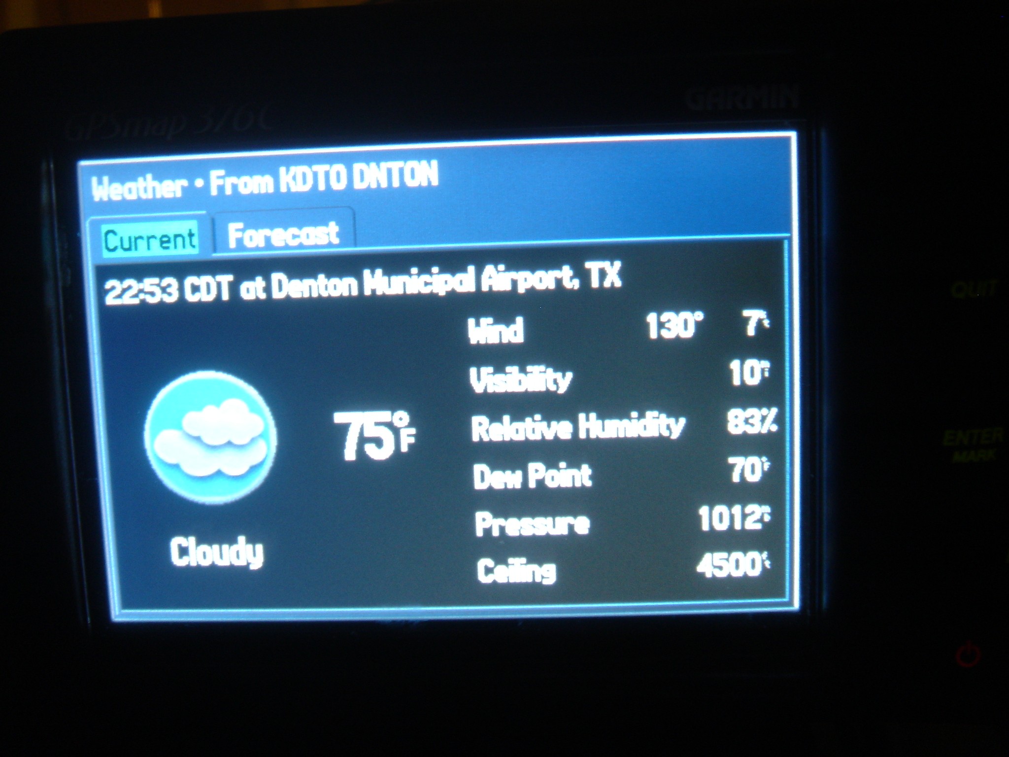
Airport Observations (You look
them up on the 376C as "Transportation" facilities and then click
"Find" then "Weather Data") that include
winds
speed and direction, visibility, barometric pressure and sometimes ceiling when
reported.
So, if you can't swing the price
of the GPSMAP 396 or the GPSMAP 496, a system like this can give
you an affordable
way to have some
in-flight situational Wx awareness.
See the details on the XM Sailor Weather
package ($29/month) that I use
HERE
Now look at the XM Aviator Lite product
details
HERE
CSOB1 reports, You decide!
Search
EBay Right Now for a 376C - New in Box units can be found for around $500,
from what I have seen.
Click the image below for a
 EBay auction of $389! (Auction quote as of 4/21/2009 and I have no financial
interest in the auction or the seller).
EBay auction of $389! (Auction quote as of 4/21/2009 and I have no financial
interest in the auction or the seller).

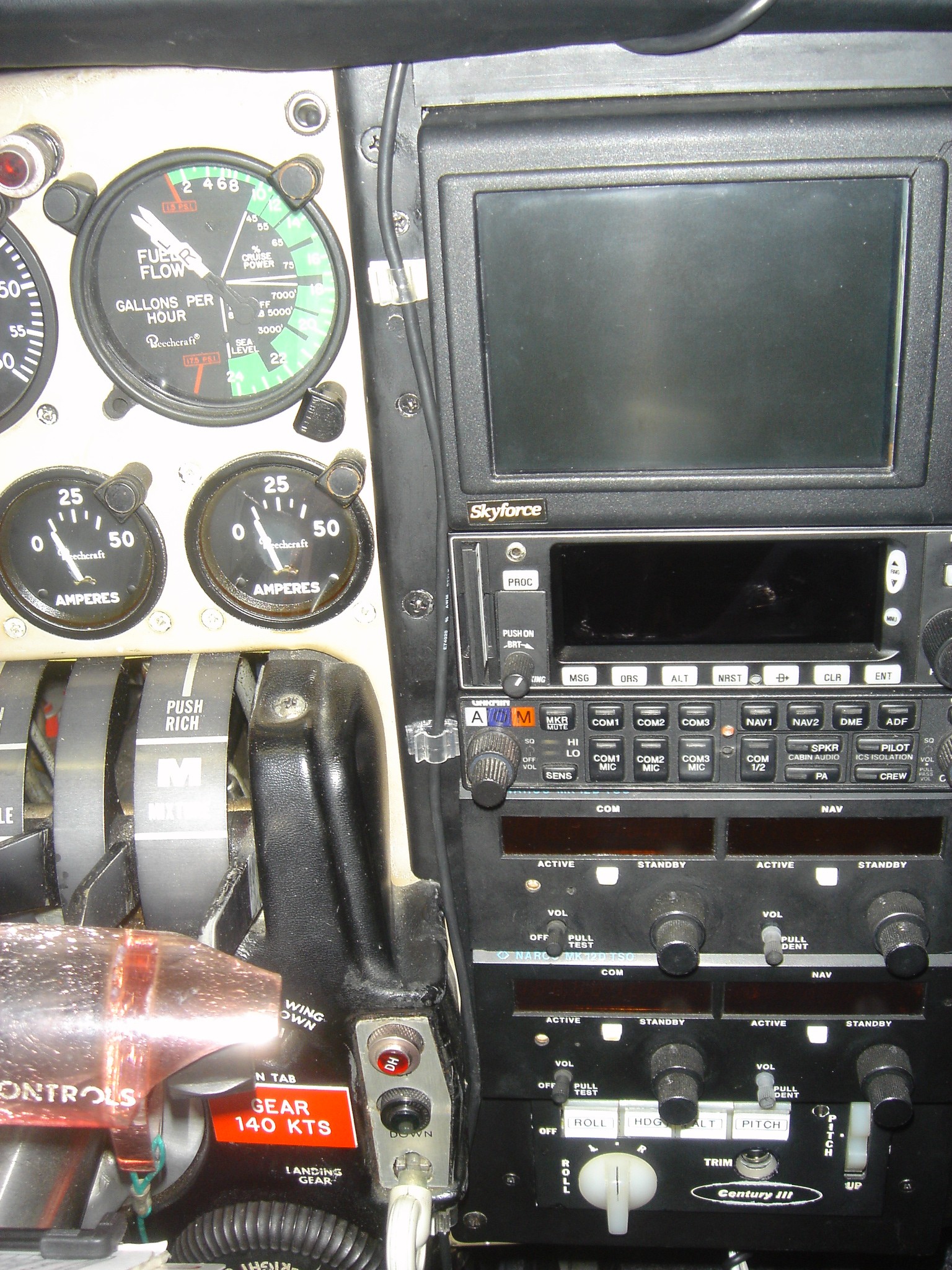
Mounting my
GPSMAP 376C (as well as other Garmin GPSMAP clones):
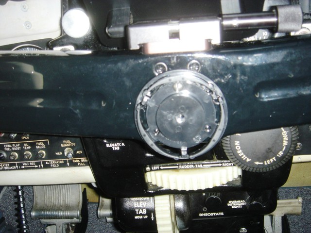
We start with the base of the
stock Garmin Marine Mount. This base is mounted to the center of the yoke by
removing the 12 o'clock position screw
in
the center circular plate. I replaced the short screw from the Cygnet yoke with
a #8-32 x1/2" stainless steel screw and screwed the base of the Garmin
Marine Mount in it's 12 o'clock position to the yoke. Confirm that this screw
does not interfere with the movement of your control arm and yoke.
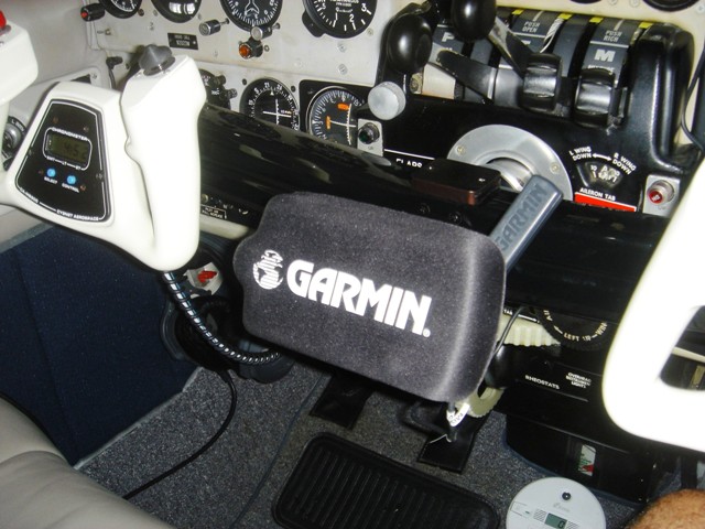
Place the marine mount with your
GPSMAP onto the base disc that you just attached to the yoke. You can see the clearance
available under the stock Cygnet Flight
Desk.
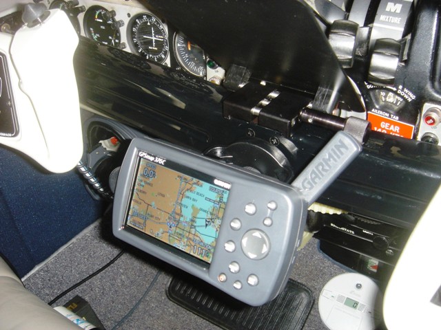
Here the unit is shown with the
flight desk removed from it's mounting pedestal. In this position I received
plenty of satellites and had WAAS position accuracy of 9 feet within about ten
minutes.
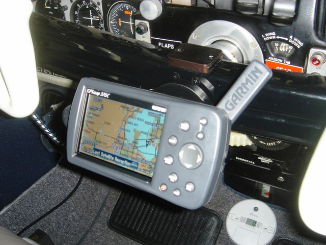
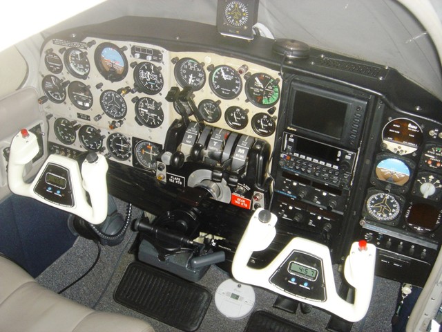
Here you see the GPSMAP in a
somewhat stowed position without the Flight
Desk.
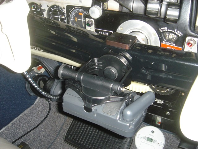
Here is the GPSMAP when stowed
with the Flight Desk in place for use.

This is the "Plain
Language" METAR interpretation that you get. Wind (speed and direction),
visibility and ceiling. This works for me! By the way, this is exactly what is
being broadcast at the time by ATIS/AWOS at the field.
These clips from True Value
Hardware keep the wires in place, eliminating dangling wire "hell" in
your cockpit.
With the Garmin GPSMAP screen cover.
Full panel with GPSMAP in stowed
position and GXM30 antenna in place on glare shield. No compass issues since magnets were removed, via the
procedure outlined by NUMA Aviation at:
Magnet Removal Procedure
HERE
If this write up has helped you
in any way, pay it forward and take a young person flying with you on your next
hamburger or pancake run!
|